
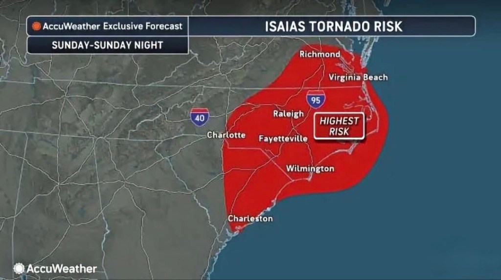
🌪️ Let’s talk about this map — because “tornado risk” from a hurricane sounds odd until you know what’s behind it.
This is AccuWeather’s tornado risk outlook for Isaias, valid Sunday through Sunday night. The red zone runs from Charleston up through Wilmington, Fayetteville, Raleigh, and into Virginia Beach and Richmond. See the “HIGHEST RISK” box? That’s eastern North Carolina, roughly along and east of I-95 — and yes, that includes Brunswick County.
What “highest risk” actually means: the National Weather Service’s Storm Prediction Center scores tornado risk in five levels, based on the chance of a tornado within 25 miles of any given point — 2% (marginal), 5% (slight), 10% (enhanced), 15% (moderate), 30% (high). A 10% number sounds small. On this scale, it’s a big deal.
Here’s the part that matters most: tornadoes from tropical systems are a different animal. They spin up fast inside the outer rain bands, they’re usually wrapped in rain so you can’t see them coming, and they favor the nighttime hours — exactly when this risk window falls. Most are on the weaker side, but “weaker” still tears roofs off and shreds mobile homes.
What to do Sunday night:
• Have a way to get warnings while you sleep — phone alerts on, weather radio if you’ve got one. Don’t count on sirens.
• Know your safe spot now: interior room, lowest floor, away from windows. In a mobile home? Line up a sturdier building ahead of time.
• When a tornado warning sounds, don’t wait to see it. Go.
Map: AccuWeather. Risk levels per the NWS Storm Prediction Center.


Leave a Reply